Aquaculture at the Bohai Bay
Background
As wild fish is a limited resource and overfishing has become an increasing problem, aquaculture is gaining more and more important. In the meanwhile the amount of fish from aquaculture exceeds that of capture fishery. China is by far the largest producer and consumer of fish from aquaculture. However, not only fish, but as well shrimps, seaweed and mussels are grown in aquaculture.
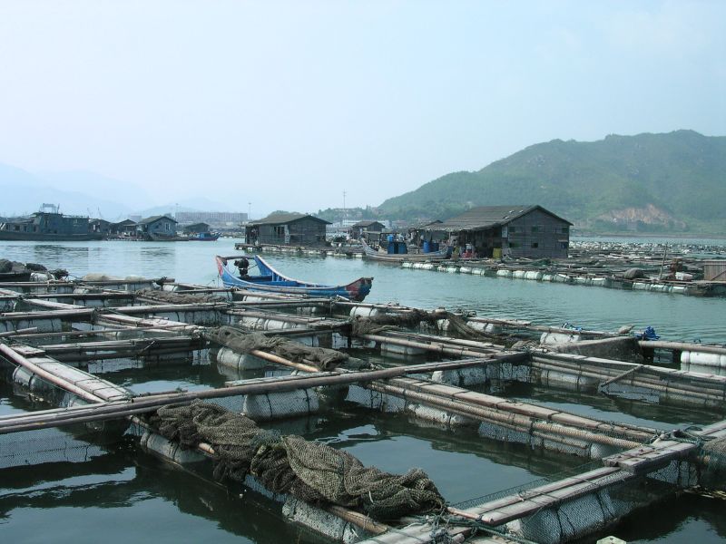 Tianjin is a major city located at the Bohai Bay in northern China. The region has a significant aquaculture industry due to its proximity to the Bohai Sea and various rivers. Commonly farmed species include fish (such as carp), shellfish, and crustaceans like shrimp. As the satellite images show, the coastal are around the Bohai Bay has been massively modified by aquaculture installations. They are connected with land reclamation, which involves converting water bodies into usable land for aquaculture purposes.
Aquaculture can pose environmental challenges, including water pollution, habitat destruction, and the use of antibiotics and chemicals. Overcrowding and improper waste management can contribute to water quality issues. Satellite data is increasingly used for monitoring and managing aquaculture activities. Remote sensing satellites provide information on water quality, temperature, and environmental changes. Satellite imagery helps assess the expansion of aquaculture farms and their impact on surrounding ecosystems.
Exercises
- Satellite Map:
- Look at the overview satellite image maps and try to estimate the area covered by aquaculture.
- Which other types of land cover and landuse can you identify?
- Look at the colour of the sea in the Bohai Bay. What does it tell about the sediment concentration of the water?
- Deselect all satellite images except the one from 1989 and zoom to the area covered by the image. Which land cover classes can you identify?
- Add the satellite images from 1989, 1997, 2007, 2010, and 2023 one by one and describe the changes. Are the aquaculture installations extending on land surfaces only?
- How can these landuse changes influence the wildlife in this region?
- How do they affect the people living there?
- EO Browser:
- Open the EO Browser.
- Find the most recent Sentinel-2 dataset covering the area displayed in the satellite map.
- Select a true colour visualisation.
- Can you identify additional, recent changes in the area (check especially the coastal region)?
- Select the false colour infrared representation. Can you identify the land-use of the most intensely vegetated areas (represented by bright red colours)?
Links and Sources
| Links:
|